Product
Introducing Exping Route 2.0 - Freeform
Introducing exping Route 2.0: A New Era of Route Creation!
The journey from version 1.0 to 2.0 has been an exciting 529-day adventure of refinement and innovation. Today, we're thrilled to unveil the result of our hard work to you all.
Why did exping initially develop the "routes" feature? We recognized that every location marked on a map holds a unique significance for each person - it's not just a coordinate, but a repository of memories. Our goal was to weave these individual map markers into more meaningful narratives through routes.
Before 2.0, exping's route creation was based on automatically generating paths from creator-marked locations. Users could either connect existing map points into a new route or create a route and add locations sequentially. The system would automatically suggest transportation modes between points.
For conventional scenarios like planning tourist itineraries or team-building activities with clear destinations and travel methods, the 1.0 route function seemed adequate. It could automatically plan routes based on map roads by simply connecting the specified locations.
However, for more adventurous use cases like hiking, cycling, or citywalks, users often traverse unmarked trails or hidden paths not shown on standard maps. The 1.0 route function fell short in meeting the creative needs of these explorers.
This realization led us to a crucial insight: only by providing creators with ample creative freedom can we empower them to imbue maps with truly unique meanings and craft one-of-a-kind cartographic experiences.
Thus, in developing route 2.0, we centered our efforts around one core principle: Freeform.
exping Route 2.0
From its inception, exping envisioned maps as a "canvas" - an alternative medium for creativity. Route 2.0 brings this concept to life more tangibly than ever. Now, creators can simply place their finger on the screen and tap or drag to freely sketch out their desired route on the map.
In route 2.0, we've unified the route creation entry point, offering two options: "Auto Plan" or "Freeform". By selecting "Freeform", creators enter an editing interface where they can choose between point-marking or freehand drawing to create their routes.
Stepping into the new "Freeform" editing interface is like opening a vast cartographic canvas. Creators can use various tools on the interface to bring their envisioned routes to life.
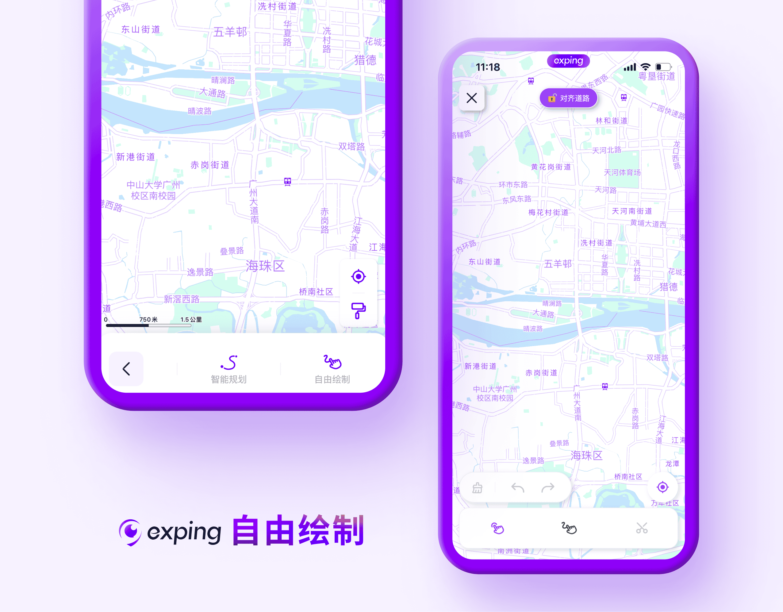
We've also introduced new interaction features. When creators opt for freehand route drawing, a preview window appears in the upper left corner of the interface during the drawing process. This magnified view of the drawing area allows for precise route adjustments.
We're confident that the new route 2.0 will unlock broader creative possibilities for our users.
Value for Creators
For individual creators, "Freeform" enables the creation of routes that more accurately reflect personal style and experiences.
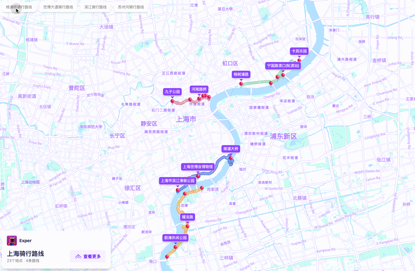
Dali Mai, an exping creator and route expert on Xiaohongshu, is passionate about sharing her curated parent-child cycling and hiking route guides.
In her shared routes, hand-drawn points and lines between locations are the primary method for presenting route information. While automatically generated routes may not always reflect the actual paths taken, hand-drawn routes on the map can more faithfully represent the real journey.
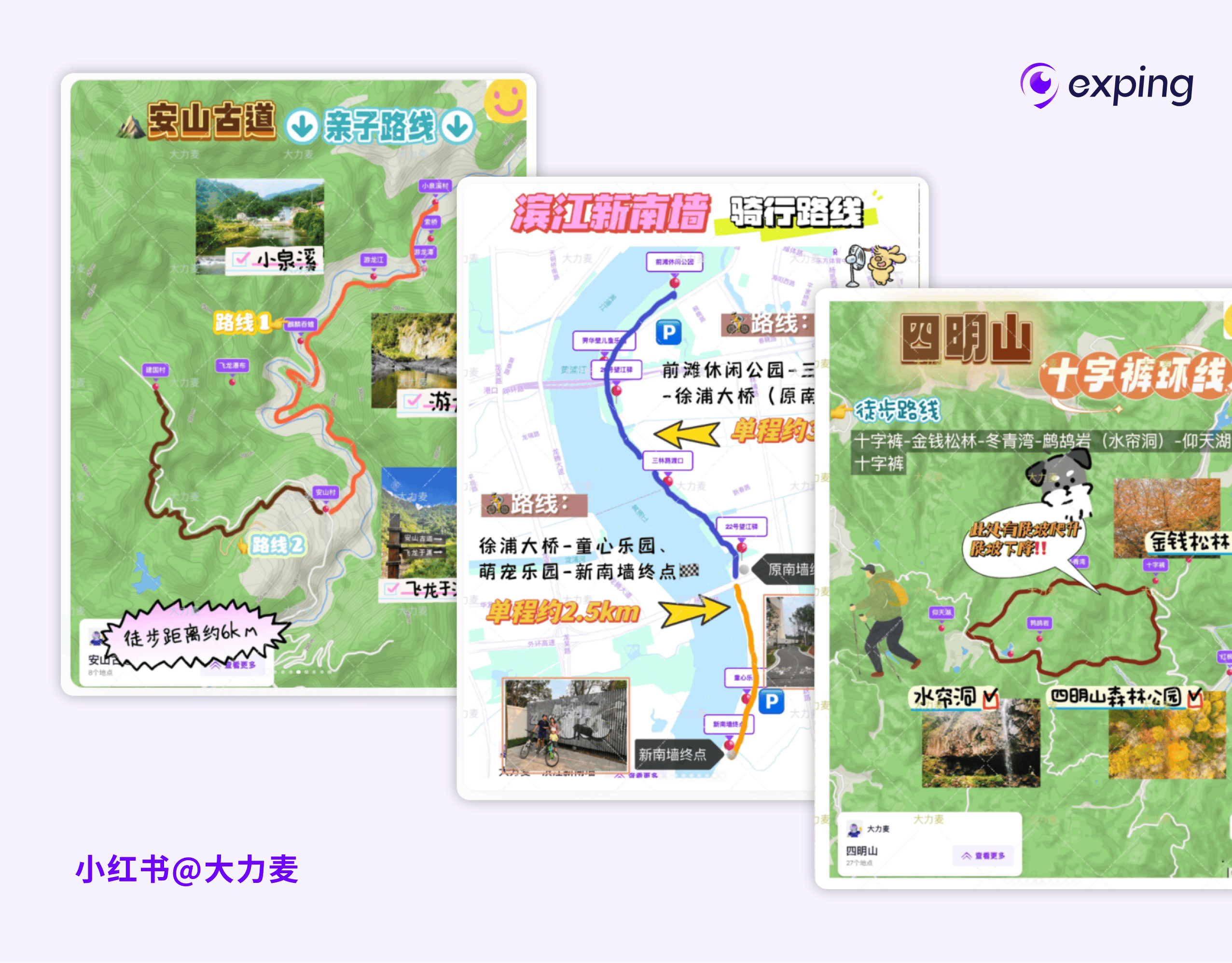
During a citywalk, you might stumble upon a flower-filled alley or discover a hidden dessert shop up a small staircase. When you want to share these hidden gems but can't plot an accurate route on a standard map, you can use "Freeform" to sketch the path of your urban wanderings directly onto the map.
For cycling maps, the automatically suggested route between points might follow main streets, but your actual cycling habit might involve crossing a bridge and following a small path. In such cases where automated planning doesn't match reality, hand-drawn maps allow you to present the true route information.
For creators with professional needs, "Freeform" enables more precise communication of route information required for work.
In team collaborations, delivery personnel might discover that turning onto a side street two blocks early before rejoining the main road is quicker than the navigation app's suggested direct route. They can quickly sketch this optimized route on the map, allowing team members to accurately follow the most efficient path and improve overall collaboration.
Event planners organizing holiday-themed activities (like Chinese Valentine's Day on May 20 or Western Valentine's Day) can draw routes on the map forming shapes like "520", "1314" (Chinese numeric expressions of love), or flower patterns. Participants can then earn prizes by completing these thematic route challenges.

Whether for personal or professional use, real or imaginary journeys, creators can now use the map as their canvas. They're free to draw any route information they wish to convey, fully experiencing the artistry of map creation.
How to Freeform Draw Routes
To begin, navigate to the map editing page, click on "Route", and select "Freeform" to enter the route creation interface.
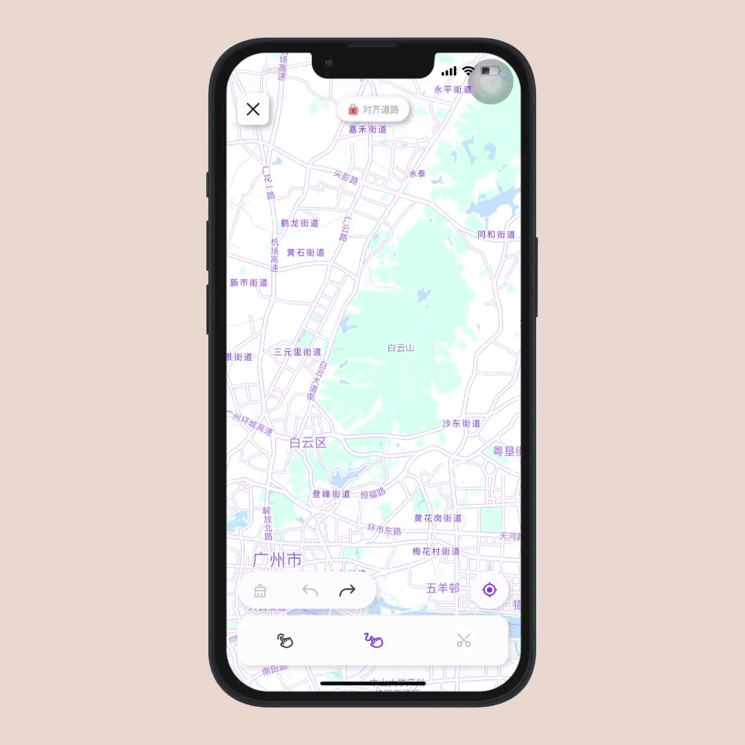
To accommodate various usage scenarios, we've included a “Align Route” toggle at the top of the interface. When you want your drawn route to automatically align with existing roads on the map, turn this feature on. If you prefer to generate routes based on your exact drawn shape, simply turn it off.
There are two methods for free drawing: point-to-point and freehand.
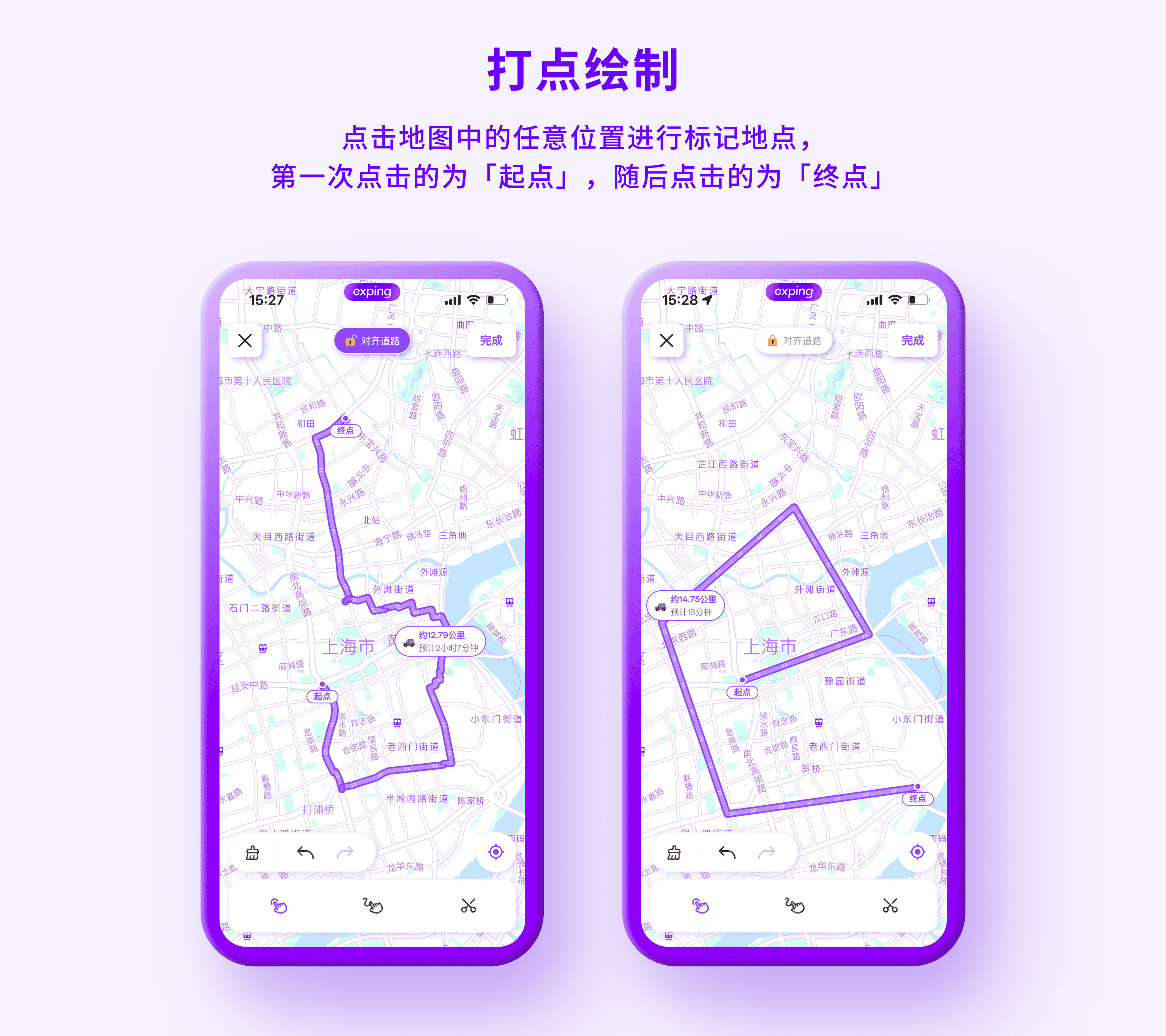
01 Point-to-Point Drawing
After selecting the point drawing tool, you can click any position on the map to mark locations. Your first click sets the "starting point", with subsequent clicks marking "waypoints" or the "endpoint".
With "Align Route" enabled, the route will align to map roads. When disabled, straight lines will connect between each pair of clicks.
!
02 Freehand Drawing
Select the freehand drawing tool and touch the screen with your finger to start sketching. As you draw, a preview window appears in the upper left corner, magnifying your drawing area for precise control.
With "Align Route" on, your route will align to map roads. When off, the route follows the exact shape you draw.

Additional Features
Regardless of your chosen drawing method, you can clear, undo, and redo routes at any time. The trimming tool allows for further route adjustments.
To trim a route, click the section you wish to modify, then use the drawing tool to redraw that portion.
The updated route 2.0 now supports custom route colors. On the map editing page, select your route, click "Color", and choose from a variety of hues to personalize your path.
Share